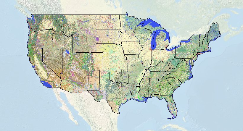
I’ve always wondered how to find the correct terminology for land cover in a given area. Usually, I just ballpark something along the lines of “oak chaparral”. Ampak zdaj sem lahko uporabite ta super nov zemljevid ki nam jih je USGS / National Biological informacijsko infrastrukturo. The level of detail is amazing, in lahko določite stopnjo natančnosti s kapljico zavihku down (1-3). Zdaj s topo zemljevid high-def ZDA lahko vidim, kje so največji stojala Monterrey bora (pravzaprav je to California Coastal Closed-Cone iglavca Gozd in Woodland) da bom lahko optimalno postaviti mojo past ta vikend.
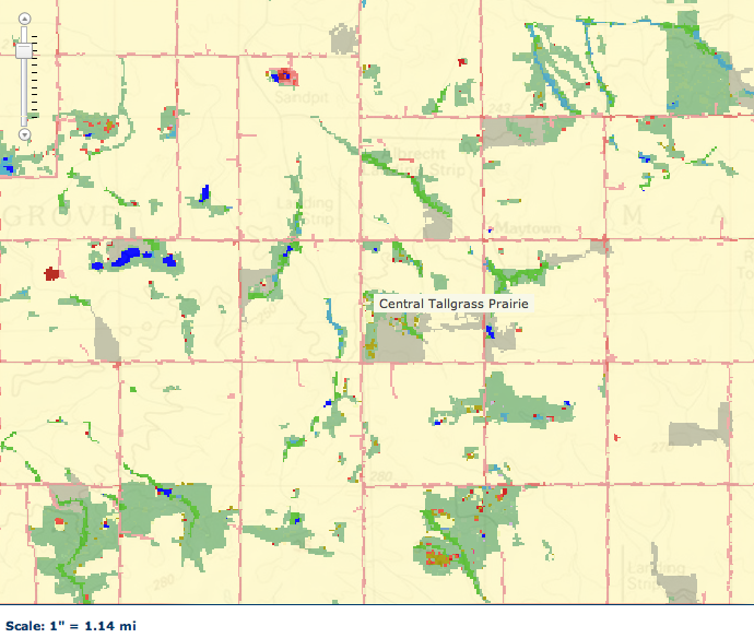
Ta zemljevid prav tako me zelo žalosten – Če greste v mojo domači državi Illinois – time yourself on how long it takes to find one pixel of “central tallgrass prairie” After a few minutes of looking for a site I knew, I finally found it. The vast expanse of light tan is cropland… and of course the prairie color is an off-shade of tan that makes it nearly impossible to see. Vendar, there it is, 4 pixels of prairie just to the left of that label and near the tiny red dot.


Very cool tool. In ja, it is depressing to visualize how small and isolated our grassland remnants truly are. I’m not sure what the figure is for Missouri, but in Illinois I believe only 7/10 od 1% of the original prairie community remains. This was the whole reason for my essay of a couple weeks ago about the lack of consideration given to invertebrates in prescribed burn management plans for our remnants here in Missouri (and which seems to have angered some of our local DNR folks).
It drives me nuts how personal some DNR/FWS/NPS/FS rangers can take legit criticism of their management practices. We have lots of anecdotal and some quantitative evidence that shows repetitive burning is probably bad for inverts – but it pisses off some park ranger who thinks they are conservation’s divine savior.
I, along with a few others, had petitioned to stop roadside mowing in a few parks/reserves back east. I don’t have a problem with a little strip of cut grass for cars…vendar sem prepričan, da veš, kako smešno lahko dobite. Še posebej, ko kosite 4-5 ogromen traktor širine nazaj na pločniku. Ko imamo samo .001% po preriji levo, košnjo, da je majhen trak avtohtone zelenjave kaznivo.
Odziv na našo zahtevo? Nekaj krajev ustavili…other rangers filed formal complaints to have our research permits revoked.
Yeesh! I guess I should be happy that all they’re doing to me is ignoring my emails. Trying to revoke permits? That’s just petulant!
Fantastic tool! I’m sad the map stops at the northern border, though 🙁